When you buy through links on our articles, Future and its syndication partners may earn a commission.

From orbit, Earth often looks more like art than geography. Satellites such as the European Union's Copernicus Sentinel missions are designed to turn that beauty into information. Rather than taking only "normal" photographs, the Sentinel-2 satellites record Earth in multiple wavelengths of light, including bands beyond human vision. Scientists then combine those wavelengths into false-color images that make it easier to tell forests from tundra, open water from ice, or bare ground from snow. The result is a view that can feel stylized while actually being highly diagnostic.
What is it?
In a recent false-color image, a Sentinel-2 satellite saw a "bauble" on Earth's surface. At a glance it resembles a red-and-white holiday ornament set into a wintry landscape. But the "bauble" is not decorative at all — it is Manicouagan crater in the Canadian province of Quebec, a remarkably circular structure that stands out even among Earth's most visible geological features.
The crater formed around 214 million years ago when an asteroid struck the region, leaving a ring-shaped scar that remains visible from space. Because of its eye-like symmetry, the formation is sometimes called the "eye of Quebec." René-Levasseur Island sits like a pupil at the center of this "eye." The feature lies roughly 435 miles (700 kilometers) northeast of Quebec City and spans about 45 miles (72 km) from east to west.
The asteroid responsible for this impact is thought to have been roughly 3 miles (5 km) in diameter, small by cosmic standards but immense by human ones. The force of that collision reshaped the bedrock, creating a structure so persistent that its geometry still dominates the landscape hundreds of millions of years later.
Where is it?
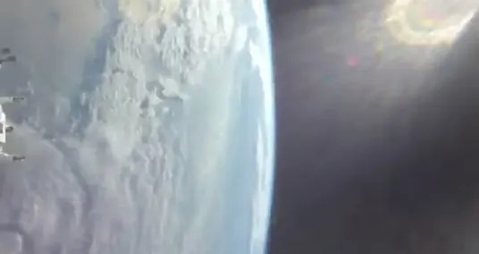
This image was taken from low Earth orbit of Manicouagan crater in the Canadian province of Quebec.

Why is it amazing?
The Copernicus Sentinel-2 satellites collect data in 13 spectral bands, delivering imagery at resolutions as fine as about 33 feet (10 meters), allowing large landforms to be seen in context while still retaining local detail. In this false-color rendering, the bright white tones are snow, while ice and frozen lake surfaces appear blue, which is particularly noticeable across the broader landscape and around René-Levasseur Island. The vivid red is not fire or bare rock; it actually marks areas of thick vegetation. That red signature corresponds to boreal forest and tundra, ecosystems that are part of a UNESCO-designated biosphere reserve, adding ecological significance to a site already famous for its geology.
While the crater may have formed in prehistoric times, the reservoir seen today — often referred to as Manicouagan Lake — was created in the 1960s as part of a hydroelectric project built to supply power across the province. In this satellite view, the Manicouagan River can be seen leaving the reservoir near the bottom of the image, a reminder that the crater's ring now functions as a managed system of water storage and flow. It's an unusual overlay of timelines: a catastrophic event from deep time, repurposed in the last century into infrastructure that supports daily life.

The image shows the difference in temperature between the top of a hurricane and the bottom.

The images reveal the storm's incredible power and offer vital insights into how such hurricanes form.

In late November, Hayli Gubbi erupted explosively, sending a towering plume of ash and volcanic gases high into the atmosphere.
Want to learn more?
You can learn more about the Copernicus program and impact craters
latest_posts
- 1
 The wolf supermoon will kick off 2026 with a celestial bang. Here's when and how to see it.
 - 2REWE launches seventh Pick&Go test store in Hanover
- 3Understanding Preschool Projects: Cultivating Abilities and Advancement
- 4Artemis 2 astronauts head for the moon after make-or-break engine burn (video)
- 5New science points to 4 distinct types of autism


- The most effective method to Perceive the Early Side effects of Cellular breakdown in the lungs
- Mom finds out she has cancer after noticing something was off while breastfeeding
- At least 490 protesters killed in Iran, activists say
- Geminid meteors streak under green sky | Space photo of the day for Dec. 19, 2025
- Euclid space telescope sees gorgeous cosmic cloud | Space photo of the day for Nov. 18, 2025
- IDF continues counterterrorism operations in Gaza Strip, including destroying terror tunnels
- Eli Lilly to build $6 billion Alabama plant as part of US manufacturing push
- Carnival fever hits Lagos as locals celebrate Afro-Brazilian heritage
- Bolsonaro briefly leaves Brazilian prison for medical tests after a fall from his bed